What would an 1890s partition of the Ottoman Empire have looked like? For instance, had Russia militarily intervened in the Ottoman Empire during the Hamidian massacres in the mid-1890s and negotiated with the other Great Powers to partition the Ottoman Empire right then and there.
There was one TL on AH.com that made an attempt at speculating at this, but what exactly do you think? Anyway, from that TL:
There was one TL on AH.com that made an attempt at speculating at this, but what exactly do you think? Anyway, from that TL:
An execution preempted: A lethal Otsu incident, Russian empire centered TL
Interesting update. Eagerly waiting for the maps...;)
www.alternatehistory.com
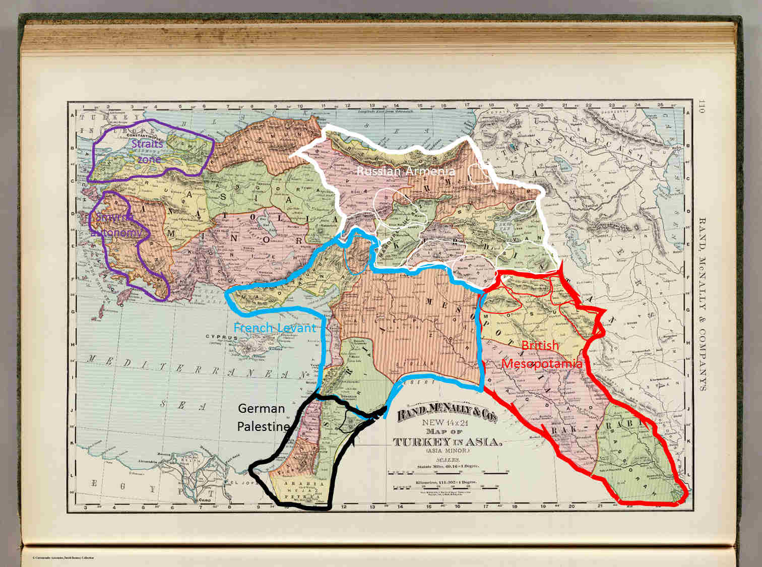
map #1: Anatolia and the Mashriq 1896
Red is British
Blue is French
White is Russian
Black is German
Purple is occupied/administered/demillitarized by the great powers+Switzeland jointly
Thin lines represent autonomous Kurd, Zaza, Yezidi, Druze and Turkmen emirates which neither the Europeans or remaining Ottoman officials are much involved in administering.
An execution preempted: A lethal Otsu incident, Russian empire centered TL
If the Hejaz still official Ottoman, then? And what about that large island between the Straits and Smira areas? All of it is still "officialy" Ottoman. What will actually happen on the ground in Arabia will be covered in the next post or two. That island is Lesbos, the hometown of Djemal. It...
www.alternatehistory.com
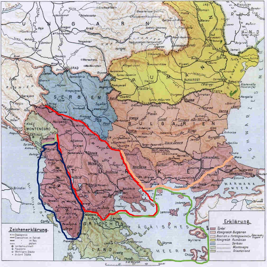
Maps #2: the Balkans 1896
Next map: The Balkans
Red is Austrian Macedon
Pink is Bulgarian Thrace.
Blue is the Emirate of Albania
Light green are territorial gains by Montenegro
Dark Green Territorial gains by Greece in the Aegean
Last edited:
")